| Kabataş | |
|---|---|
| — District — | |
| Location of Kabataş within Turkey. | |
|
Kabataş
|
|
| Coordinates: | |
| Country | Turkey |
| Region | Black Sea |
| Province | Ordu |
| Government | |
| • Mayor | Yakup Yılmaz (AKP) |
| Area | |
| • District | 75 km2 (29 sq mi) |
| Elevation | 701 m (2,300 ft) |
| Population (2000)[1] | |
| • District | 20,644 |
| • Density | 275.25/km2 (712.9/sq mi) |
| • Urban | 9,211 |
| Time zone | EET (UTC+2) |
| • Summer (DST) | EEST (UTC+3) |
| Postal code | 52xxx |
| Area code(s) | 0452 |
| Licence plate | 52 |
| Website | www.kabatas.bel.tr |
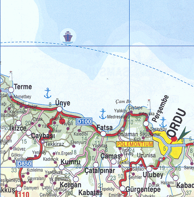
Kabataş, formerly Karay, is a town and district of Ordu Province in the Black Sea region of Turkey. According to the 2000 census, population of the district is 20,644 of which 9,211 live in the town of Kabataş.[1][2] The district covers an area of 75 km2 (29 sq mi),[3] and the town lies at an elevation of 701 m (2,300 ft).
Formerly the village of Karay, Kabataş is in the Canik Mountains, 40 km inland from the Black Sea coast. The area was conquered by the Anatolian beylik of Hacı Emiroğulları in 1380.
|
||||||||||||||||||||||||||||||||||